Mini heatwave: will the very warm weather last?

- Published
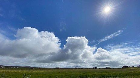
This week has seen strong sunshine and rising temperatures.
An area of high pressure has moved over the UK bringing strong sunshine and the warmest weather of the year so far.
Many people will be hoping it stays that way this weekend. But, as we know, the weather can change very quickly at this time of year.
A barbecue weekend?
High pressure means a stable atmosphere and dry weather. There will be a good deal of sunshine on Saturday after any early misty low cloud soon clears.
Take care in the sunshine though. The Sun is as strong now as is it is in August and UV levels are forecast to be high for much of the country.
The only fly in the ointment on Saturday - the chance of a few showers. Scotland looks most at risk of a scattering of showers but there could be one or two in Northern Ireland.
Wherever you are it will be warm for the time of year. Maximum temperatures will be typically 21-25 Celsius.

Temperatures reached 24.6C in London on Thursday
Dramatic change on the way
Our area of high pressure is blocking the progress of rain-bearing weather systems for a while with the jet stream diverting them away from our shores.
But it is expected that this will change. As the high pressure retreats to Scandinavia on Sunday, pressure will fall across the UK.
Western parts of the UK will see a change first.
Showers and possible thunderstorms are forecast for Sunday and as a result the temperature will be lower.
The Met Office has issued a yellow thunderstorm warning valid from 11am to 10pm on Sunday. This warning covers western parts of Northern Ireland and most of Wales and western England. It warns that heavy showers and thunderstorms could lead to travel disruption and flooding.
East is best.
At the moment it looks like eastern areas will still be very warm on Sunday with temperatures again reaching the mid-20s at best.

Met Office yellow thunderstorm warning areas for Sunday
What about next week?
If you are hoping the dry, sunny and warm weather will return, I am afraid you are going to be disappointed.
Next week as a whole looks dramatically different to the weather over the past few days. Instead of high pressure bringing warm sunshine, low pressure will be sitting uncomfortably close to the UK. This would mean more rain and lower daytime temperatures.
You will get the picture from looking at the BBC Weather app. The details will change but showers or longer spells of rain are never too far away. It won't be a wash out though. Temperatures will be near or above average, just not as warm as it is now.
So, after a brief taste of some much needed dry and warmer weather this week, we could be back to square one next week.

Give a not so warm welcome to low pressure early next week
More from BBC Weather
- Published17 May 2023
- Published3 May 2022
- Published1 May