By Holly Richardson, ABC Far North
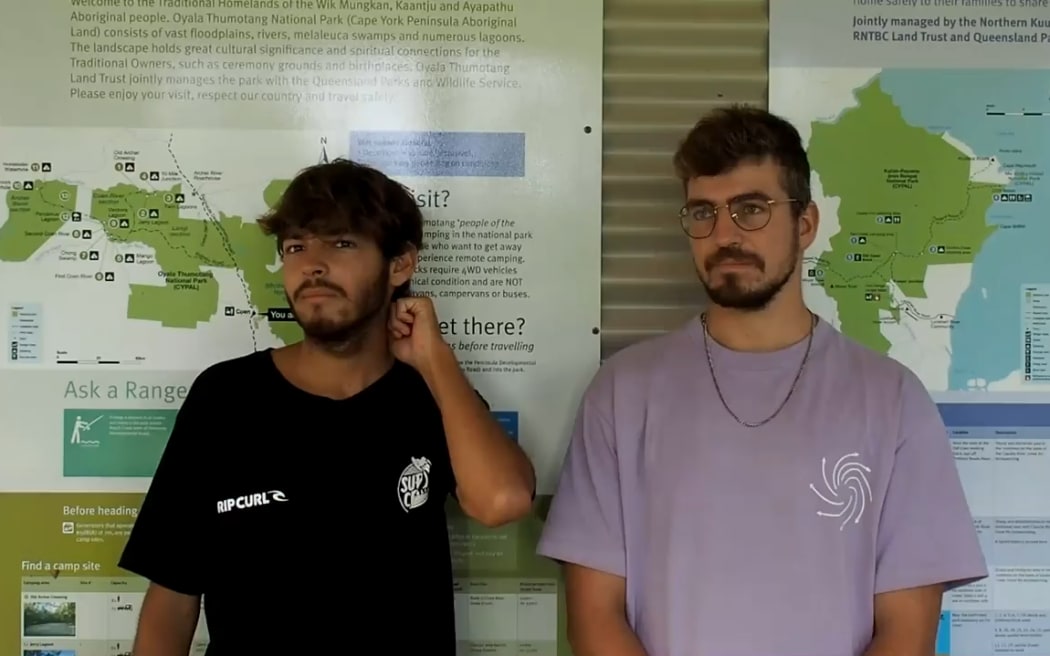
German tourists Philipp Maier, left, and Marcel Schoene tell of their unplanned adventure. Photo: Supplied / Queensland Department of Environment and Science
Two young men are lucky to be alive after walking for several days in the Cape York wilderness when their car became bogged after they followed Google Maps directions.
German tourists Philipp Maier and Marcel Schoene left Cairns on 4 February and headed off to travel through Cape York in a four-wheel-drive vehicle.
They told Queensland Parks and Wildlife Service (QPWS) rangers they had been following the directions on Google Maps on their way to Bamaga.
Google Maps told them to enter Oyala Thumotang National Park through a dirt track known as Langi Track, which leads to the old Archers Crossing.
On 6 February, their vehicle became bogged and without any phone service they became stuck.
The pair camped for about a week before attempting to walk to Archer River and then Coen, which took several days.
Maier said he and his fellow traveller had been following Google's directions.
"In Coen, Google Maps said we should go to the national park right away, and we thought just do it because maybe the main road is closed because of a high river," he said.
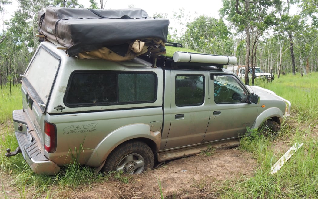
The men's car became bogged in muddy terrain and was later recovered. Photo: Supplied / Queensland Department of Environment and Science
He said they drove through the national park for 50 to 60km before they became stuck.
"The roads were quite good because the weather was quite dry for the past few days and the creeks were knee-high, maybe," Maier said.
"Where we got stuck, it looked really dry. The surface was dry, but under the surface it was really wet and muddy."
He said their car became stuck in a hole.
"[It was] almost impossible to get out of there," he said.
The men said they initially tried to walk to Archer River because it was closer, but when they reached the river the water was too high to cross.
Schoene said they tried to cross over the river on a fallen tree.
"We went on the fallen tree to come over the other side, then at the night we had to sleep there and it started to rain and we couldn't go further up," he said.
He said the pair built a shelter out of wood in the landscape.
"It wasn't very good, it wasn't very safe," he said.
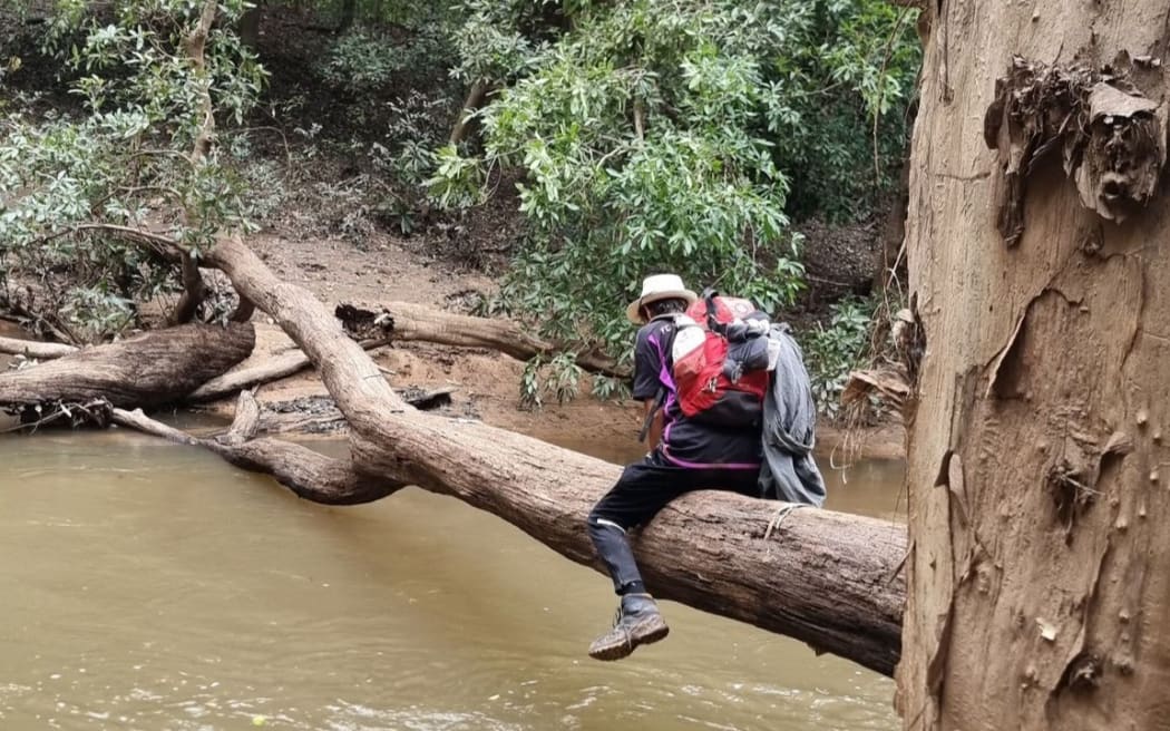
The pair had to cross a swollen river on a fallen tree during their ordeal. Photo: Supplied / Queensland Department of Environment and Science
Maier and Schoene said they had several wildlife encounters including a crocodile and a snake, a lot of spiders, as well as several cows and wild pigs.
Maier said they mostly walked during the early mornings, stopping during the heat of the day, before continuing until late at night.
Hard decision to start walking
Schoene said the decision to leave their car was hard.
"It was a very bad feeling, very weird," he said. "But after 10-20 kilometres, we never thought about it."
He said they walked for about 22 hours, through rain, sleeping on the road at night and using a drone to look for nearby roads.
"We had our backpacks with us, like 12 kilos on the back, so all the important stuff we had with us," he said.
The pair spoke with rangers after their ordeal and were unharmed but did have lessons they would take with them.
"Never trust Google Maps on your own," Schoene said.
Maier said it was a happy ending but a difficult few days.
"It was a good experience but it was a really hard experience. I don't want to live this week another time," he said.
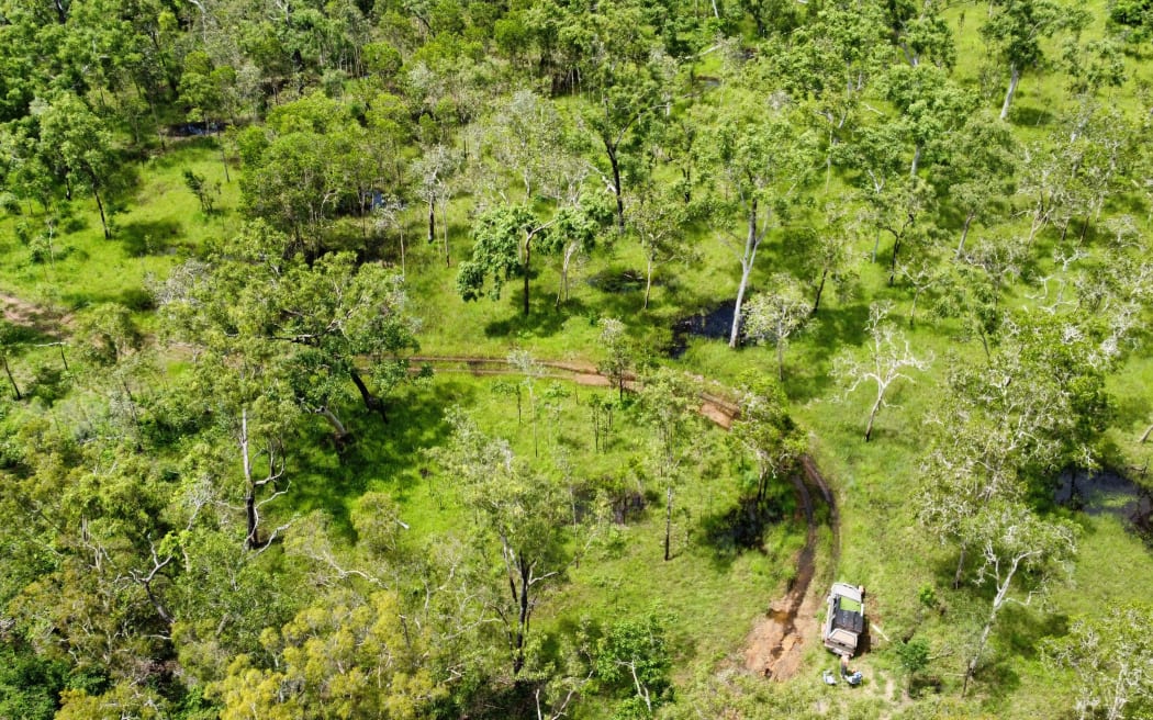
The pair took drone footage of the remote area they were travelling in. Photo: Supplied / Queensland Department of Environment and Science
Ranger in charge Roger James said QPWS and a local mechanic helped recover the vehicle, but the situation could have been a lot worse.
"These men ended up on foot in oppressive conditions and although they had supplies and a shelter for sleeping, they are extremely lucky to be alive," he said.
"In this case, we were quite lucky we were recovering a vehicle, not bodies, but it could have been much different."
He said if the men had not been as young, fit, prepared and motivated, it could have ended tragically.
"These men tried crossing a river on a fallen log, endured intense heat and storms, encountered cattle, pigs, and crocodiles and had to sleep in the bush."
He said it was not the first time tourists had been sent the wrong way through the national park by Google Maps.
"We've got no idea why this is happening, there aren't even any crossings on the Archer River," he said.
Google Maps problems
In December, a frustrated council in Western Australia erected signs warning drivers against using Google Maps after GPS-based directions repeatedly sent travellers down unsafe roads.
And in November, landowner Graham Anderson invented his own road sign to direct travellers regularly getting lost near his property at Isla, about four hours' drive west of Bundaberg.
He discovered drivers were following Google Maps across his cattle property in search of the spectacular Isla Gorge, which had an entrance almost 20 kilometres further along the Leichhardt Highway.
- This story was first published by ABC.