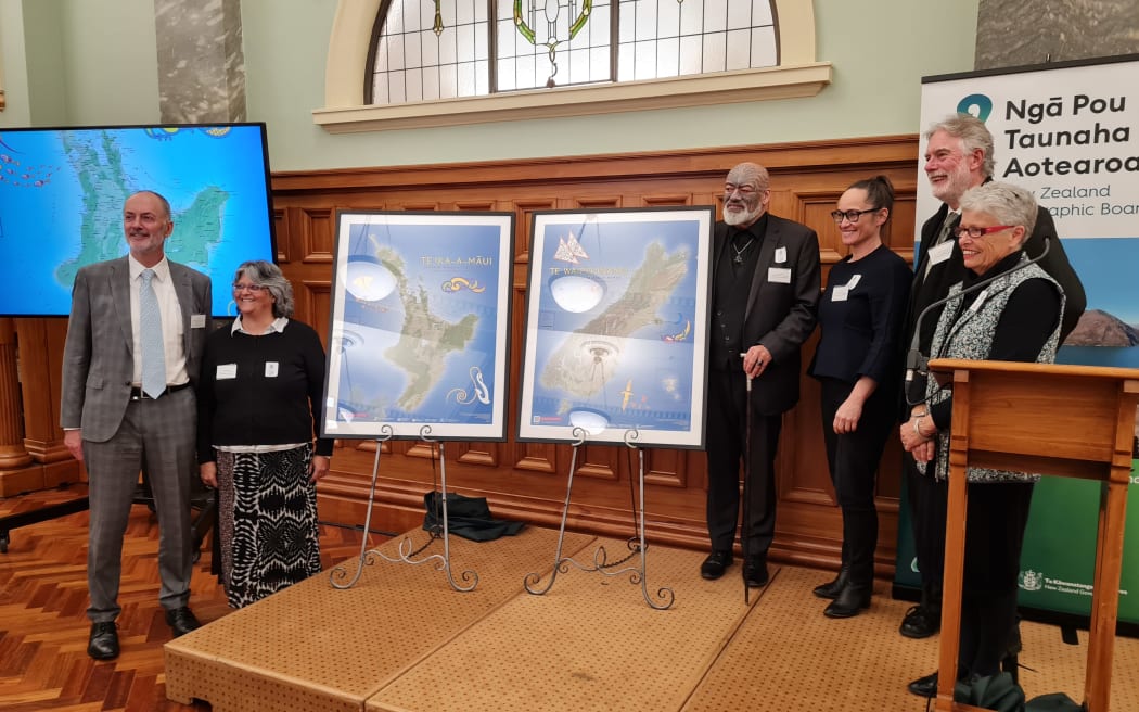
New Zealand Geographic Board members at the launch of the new Māori and Moriori place names maps. Photo: RNZ / Pokere Paewai
The New Zealand Geographic Board has launched a new set of tangata whenua place names maps.
The maps, updated for the first time since 1995, present Māori and Moriori place names as they were prior to European settlement.
The two maps, one for Te Ika a Māui and one for Te Waipounamu, contain about 900 names each, from Te Rerenga Wairua all the way down to Rakiura.
That includes mountains, pā, wāhi tapu and māhinga kai, collected from iwi and hapū groups or made official through Treaty of Waitangi settlements.
Many of the names were sourced from a never-published 1940s centennial atlas, with the Māori names compiled by Sir Āpirana Ngata.
But the board also worked closely with iwi groups to gather the information and stories behind each name.
New Zealand Geographic Board secretary Wendy Shaw said iwi had the ultimate choice of what was included in the maps and what was left out.
"The names that are most significant and important to them are the ones that got included, obviously and one to one million [scale] we can't show every single name and so there had to be a cartographic choice as to which names could be shown."
Shaw said it is important that the maps show Aotearoa as it was in 1840 prior to widespread European migration.
"We were really trying to keep the integrity of the map pre-1840 because some of the names that apply to features back then, the features don't actually exist now."
This includes much larger glaciers in the Sourthern Alps Kā Tiritiri-o-te-Moana, the old Napier harbour Te Whanganui-a-Orotū and a pre-eruption Mt Tarawera.
Minister for Land Information Damien O'Connor was there to launch the maps.
He said there's been an energy in recent years to pronounce Māori place names correctly.
The maps will help both to refer to history and to bring people up to date with Te Reo Māori, he said.
"It's a step forward and as we wander around our country we will see some of the old historic maps that came from Captain Cook's voyage and we are all quite proud of those, I'm sure that actually as we move forward people will have these maps in place."
In recent years there has been a move towards restoring Māori place names, such as in the far north where Russell might become Kororāreka once again.
Surveyor General and Chair of the New Zealand Geographic Board Anselm Haanen said the board restores Māori place names where the community is generally in support.
"People whether Māori or non-Māori have strong connections to places where they were brought up and and where they know, so the board doesn't routinely go around changing names without just cause but the board does have a statutory function to recognise original Māori place names."
He said the recognition of Māori place names is often transitional as in the case of Mt Taranaki.
The maps will be sent out to every school in the country, and a set of maps will be sent to every marae and iwi organisation by the board.
Haanen said they will support the new Aotearoa History curriculum.
"I think it helps to tell some of the stories behind these place names so it's one thing to see the name but a lot of people, including Māori for that matter don't always know where the names come from and what they mean."
The maps will soon be available to purchase and can be downloaded through the Land Information New Zealand Website.